GNSS RTK System
Fast, reliable coordinate capture is now a basic requirement in construction layout, topographic survey, utility mapping, and many other field workflows. When teams need centimeter-level positioning without waiting for long post-processing cycles, a GNSS RTK System becomes the practical choice for real-time survey work.
This category focuses on RTK-capable solutions used to collect, stake out, and verify positions directly in the field. It also sits within a broader survey ecosystem where satellite positioning is often combined with subsurface investigation, speed measurement, or other motion and position tools depending on the project scope.
Why RTK remains a core method in modern field surveying
Real-time kinematic positioning is built around a simple operational logic: a base station or correction source provides error corrections, while the rover calculates precise coordinates on site in real time. Compared with static GNSS workflows, this approach reduces waiting time and helps surveyors validate results immediately during measurement.
That real-time feedback is especially useful in construction staking, boundary checks, topographic detail collection, and as-built surveys. Instead of returning to the office to confirm data quality, crews can review point status in the field and repeat measurements when site conditions affect satellite tracking or communication stability.
Typical equipment found in a GNSS RTK setup
A complete RTK workflow usually includes the receiver, controller or field software, power supply, and a communication method for correction data. The exact configuration depends on whether the job uses radio corrections, network RTK, or a mixed deployment across different sites.
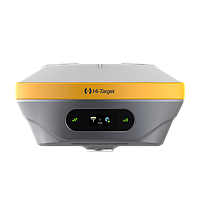
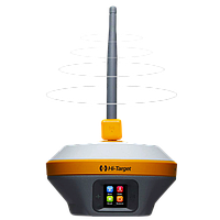
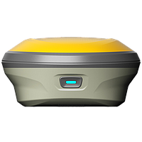
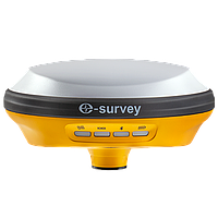
Within this category, models from AlphaGeo illustrate the portable rover side of the workflow well. The AlphaGeo L300 RTK GNSS RECEIVER is positioned as a multi-constellation unit for everyday survey tasks, while the AlphaGeo Matrix II RTK GNSS RECEIVER adds features such as camera-assisted operation and a wider tilt compensation range, which can help improve productivity when direct pole leveling is less convenient.
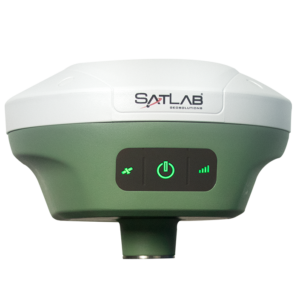
For buyers comparing brands and survey platforms, manufacturer pages such as SATLAB and AlphaGeo can also be useful starting points when evaluating ecosystem compatibility, controller preferences, and deployment style across multiple crews.
How to choose the right GNSS RTK System for your application
The best selection process starts with the job, not the datasheet. In open construction sites, teams often prioritize stable correction handling, long battery operation, and efficient point collection. In urban corridors or partially obstructed environments, the focus shifts toward signal tracking, tilt compensation behavior, and how well the receiver maintains usable solutions when site conditions are less than ideal.
Multi-constellation tracking is an important consideration because it improves satellite availability across varied conditions. Battery endurance, onboard storage, communication interfaces, and weight also matter in daily operation, especially for crews moving continuously between control points, detail shots, and layout tasks.
It is also worth considering whether the system will be used only as a rover or in both base and rover roles. A more flexible setup may support broader project demands over time, particularly for contractors and survey teams that work across both control establishment and routine field measurement.
Where RTK fits within the wider survey workflow
RTK is often one part of a larger measurement process. A project may begin with control planning, continue with real-time point collection, and later extend into verification, mapping, or specialized inspection. In some field programs, positioning data is paired with subsurface survey tools to add location context to underground findings.
That is where brands such as Guidelinegeo become relevant. While Guidelinegeo is better known here for ground penetrating radar platforms such as the ProEx MALÅ Professional Explorer System, MIRA 500 HDR Ground Penetrating Radar, and EASY LOCATOR CORE MALÅ Easy Locator, these systems are often used alongside accurate positioning workflows to support utility mapping, archaeology, and infrastructure assessment.
For teams working across multiple sensor types, related categories such as hydrography and oceanography survey equipment may also help when a project extends beyond land-based RTK measurement into broader geospatial data collection.
Comparing RTK with static GNSS in practical deployment
Both methods rely on satellite observations, but they solve different field problems. Static GNSS is usually chosen for control networks and reference points where longer observation sessions and post-processing are acceptable. RTK, by contrast, is designed for mobility and immediate decision-making in the field.
In practice, many survey teams use both methods on the same project. Static observation may be used to establish control, while RTK handles day-to-day detail collection and layout. This combined approach supports both coordinate reliability and jobsite efficiency without forcing every task into a single measurement method.
Buyers evaluating a GNSS RTK system should therefore think beyond nominal accuracy alone. Workflow compatibility, survey speed, and the ability to maintain productivity under real site conditions usually have just as much impact on project performance.
Field conditions that affect RTK performance
No RTK system operates in isolation from the environment. Buildings, heavy tree cover, reflective surfaces, and unstable correction links can all interrupt solution quality. Even when a receiver supports many satellite signals, performance still depends on antenna exposure, communication stability, and disciplined field procedure.
Tilt compensation, integrated storage, and efficient power management can improve the user experience, but they do not replace good survey practice. Crews still need to monitor fix status, check control points, and confirm that the correction source remains consistent throughout the measurement session.
This is one reason professional buyers often compare not only receiver specifications but also the operating model behind the system: software workflow, field usability, charging method, and how easily the equipment fits into existing project routines.
Examples of product direction within this category
The AlphaGeo L300 RTK GNSS RECEIVER is suited to organizations looking for a compact RTK receiver with broad satellite tracking capability for standard survey and construction tasks. The AlphaGeo Matrix II RTK GNSS RECEIVER targets more advanced field use with added camera-related functions, internal storage expansion, and a lightweight design that may appeal to crews working long hours on mobile survey assignments.
Although this category centers on RTK, some projects also involve complementary measurement technologies. For instance, Guidelinegeo systems such as GeoDrone 80 Ground Penetrating Radar or the MALÅ Ground Explorer series demonstrate how geospatial projects can evolve from surface positioning into underground investigation, corridor scanning, or utility-focused survey workflows.
Choosing with long-term use in mind
A well-matched RTK solution should support the way your team actually works: site to site, crew to crew, and project to project. That means looking at more than a headline spec. Communication method, correction availability, portability, and compatibility with your existing survey process all influence long-term value.
If your work regularly includes layout, topo survey, as-built measurement, or field verification, this category provides a practical starting point for comparing RTK-ready equipment and related survey technologies. A careful selection today can reduce rework, improve field efficiency, and make future expansion into connected survey workflows much easier.
Get exclusive volume discounts, bulk pricing updates, and new product alerts delivered directly to your inbox.
By subscribing, you agree to our Terms of Service and Privacy Policy.
Direct access to our certified experts