
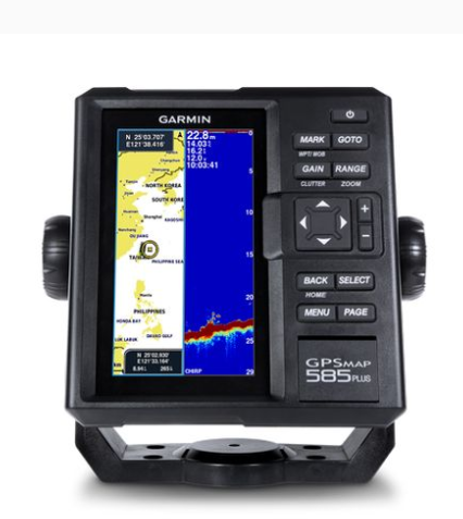
GARMIN GPSMAP 585 Plus Fishfinder
Physical dimensions: 176.0 mm x 190.0 mm x 66.0 mm (6.93” x 7.48” x 2.60”)
Display size, WxH: 2.83" x 5.36"; 6.0" diagonal (72.0 mm x 136.2 mm; 152.4 mm diagonal)
Display resolution, WxH: 480 x 800 pixels
Display type: WVGA display
Weight: 816.0 g (1.80 lbs)
Water rating: IPX7
GPS receiver: GPS/GLONASS/BeiDou, internal
NMEA 0183/RS422 compatible: V
Power consumption: 7.6 W
Voltage range: 10V - 36V DC input
Mounting options: Bail or flush
Maps & Memory
Preloaded maps: GPSMAP 585 Plus, APAC (worldwide basemap) GPSMAP 585 Plus, w/g2, SEA (built-in SEA g2 chart)
Accepts data cards: 2 standard SD
Waypoints: 12,000
Routes: 200
Track log: one 50,000 points active track; 100 saved tracks
Chartplotter Features
Garmin Sonar compatible: V
Supports AIS (tracks target ships position): V
Supports DSC (displays position data from DSC-capable VHF radio): V
Tide tables: V
Sonar Features & Specifications
Transmit power: 600W (RMS)
Sonar Frequency: 50/77/200kHz CHIRP (Low, Mid, High)
ClearVü™: (built-in)
Scanning Sonar Frequency: CHIRP 260/455/800kHz
Maximum depth: 2,300 ft, freshwater, 1,100 ft, saltwater (depth capacity is dependent on water bottom type and other water conditions)
Bottom lock (shows return from the bottom up): V
Water temperature log and graph: V
Split-screen zoom: V
Fish Symbol ID (helps identify fish targets): V
Sonar recording: V
Sonar history rewind: V
Connections
Transducer Connector Pin Numbers: 8
8-Pin Power/NMEA 0183 Connector: 1
BNC for External GPS Antenna: 1
Get exclusive volume discounts, bulk pricing updates, and new product alerts delivered directly to your inbox.
By subscribing, you agree to our Terms of Service and Privacy Policy.
Direct access to our certified experts