
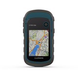
GARMIN ETREX 22X GPS
Physical & Performance
Physical dimensions5.4 x 10.3 x 3.3 cm
Display size, WxH3.5 x 4.4 cm; 5.6 cm diag
Display resolution, WxH240 x 320 pixels
Display type2.2" transflective, 65K colour TFT
Weight141.7 g with batteries
Battery2 AA batteries (not included); NiMH or Lithium recommended
Battery lifeUp to 25 hours
Water ratingIPX7
High-sensitivity receiver
InterfaceUSB
Camera No
Maps & Memory
Basemap
Preloaded maps
Yes - Garmin TopoActive map of Western Europe
Ability to add maps
Built-in memory3.7 GB including preloaded maps
Accepts data cardsmicroSD™ card (not included)
Custom POIs (ability to add additional points of interest)
Waypoints/favorites/locations2000
Routes200
Track log10,000 points, 200 saved tracks
Outdoor Features
Automatic routing (turn by turn routing on roads)Yes (with optional mapping for detailed roads)
Geocaching-friendlyYes (Paperless)
Custom maps compatible
Sun and moon information
Tide tablesYes (with optional Bluechart)
Area calculation
Picture viewer
Physical & Performance |
|
| Physical dimensions | 5.4 x 10.3 x 3.3 cm |
| Display size, WxH | 3.5 x 4.4 cm; 5.6 cm diag |
| Display resolution, WxH | 240 x 320 pixels |
| Display type | 2.2" transflective, 65K colour TFT |
| Weight | 141.7 g with batteries |
| Battery | 2 AA batteries (not included); NiMH or Lithium recommended |
| Battery life | Up to 25 hours |
| Water rating | IPX7 |
| High-sensitivity receiver | |
| Interface | USB |
| Camera |
No |
Maps & Memory |
|
| Basemap | |
| Preloaded maps |
Yes - Garmin TopoActive map of Western Europe |
| Ability to add maps | |
| Built-in memory | 3.7 GB including preloaded maps |
| Accepts data cards | microSD™ card (not included) |
| Custom POIs (ability to add additional points of interest) | |
| Waypoints/favorites/locations | 2000 |
| Routes | 200 |
| Track log | 10,000 points, 200 saved tracks |
Outdoor Features |
|
| Automatic routing (turn by turn routing on roads) | Yes (with optional mapping for detailed roads) |
| Geocaching-friendly | Yes (Paperless) |
| Custom maps compatible | |
| Sun and moon information | |
| Tide tables | Yes (with optional Bluechart) |
| Area calculation | |
| Picture viewer | |
Get exclusive volume discounts, bulk pricing updates, and new product alerts delivered directly to your inbox.
By subscribing, you agree to our Terms of Service and Privacy Policy.
Direct access to our certified experts